Tool Hire
Surveying & Location Equipment Hire
Surveying and location equipment are essential tools in the construction industry, providing precise measurements and accurate data for every stage of a project. We deliver a range of surveying and location equipment including the latest technology for efficient and effective data collection.
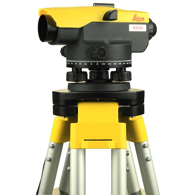
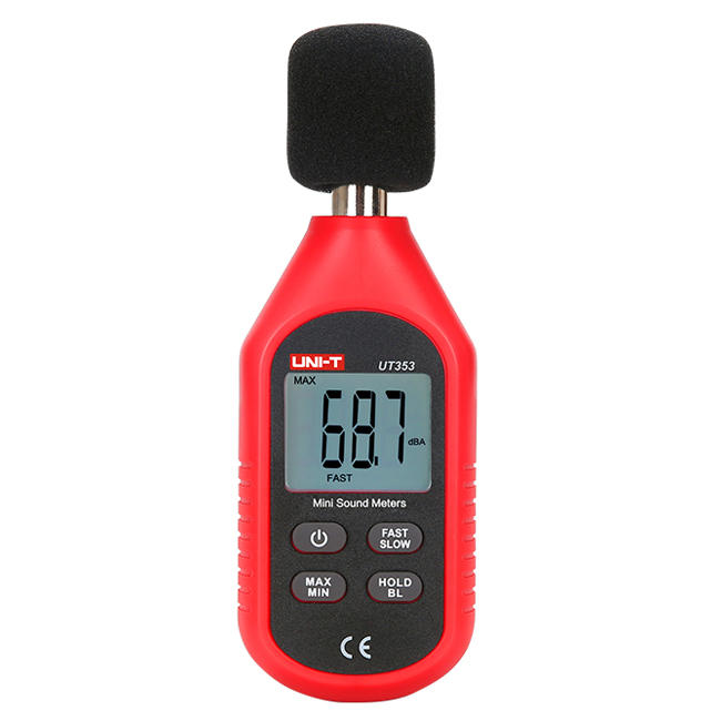
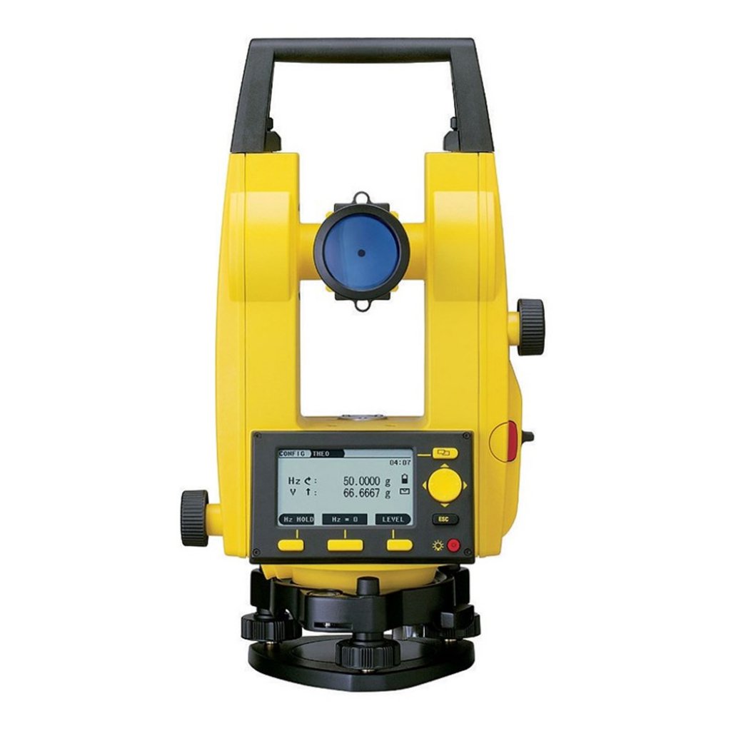
We can source laser levels, total stations, and theodolites that offer high precision and accuracy in measuring angles, distances, and elevations. These tools are designed to withstand tough construction site conditions and are easy to use, making them ideal for all levels of experience.
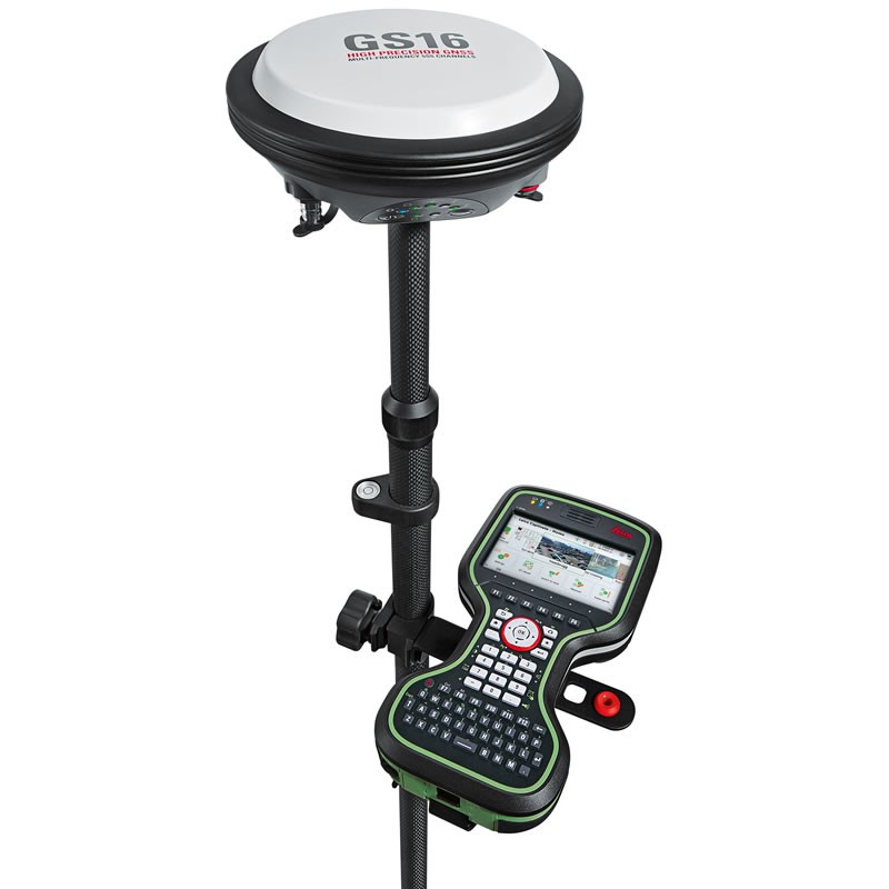
We also offer GPS equipment, including handheld GPS units, mapping software, and GNSS receivers, which allow you to map and survey large areas with ease. With advanced features like real-time data collection, automatic target acquisition, and satellite imagery, these tools provide reliable and accurate data for your projects.
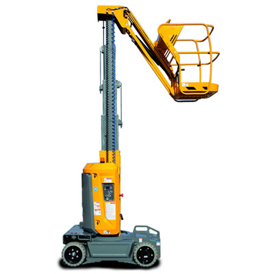
We only source surveying and location equipment that is suitable for a variety of applications, including land surveying, construction staking, and topographical mapping. Whether you’re a professional surveyor or working on a construction project, you’ll find the right equipment for your needs in our range. Browse our selection today and invest in quality, reliable surveying and location equipment for your next project.

OTHER PRODUCTS TO HIRE
Looking For Other Surveying & Location Equipment To Hire?


access the uk's largest digital supplier network
Over 2,000 Depots, And 900 Suppliers Across The UK.


Save money. save the planet.
95% of products we help source are delivered within 15 miles of our customer's projects.
That's 75% closer than the construction industry average of 60 miles.

Reduce wasted miles
We will always match your booking to the closest, available suppliers.
Expand your margins
Tackle overspending by leveraging a hyper-localised supply chain.
Hit your sustainability targets
Stipulate a radius to achieve your considerate constructor mandates.
Reach Net Zero by 2050
Zero emission options including electric equipment and recycled materials.
DIGITAL CONSTRUCTION SUPPLY CHAIN MANAGEMENT
Our Focus Is To Make Your Supply Chain More Efficient.
Reduce time spent sourcing equipment and suppliers.
Finally, a solution for streamlining your procurement. In the YardLink platform, you can hire equipment, from any supplier, through a single account. Reduce time spent translating requirements from site, communicating with multiple suppliers and comparing non-standardised quotes. And the best part, it’s free.
Learn More“Being able to manage all of our suppliers, in one platform, is a life-saver.”
Always know what's on site. Never let inventory go to waste.
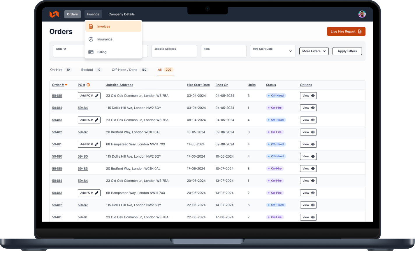
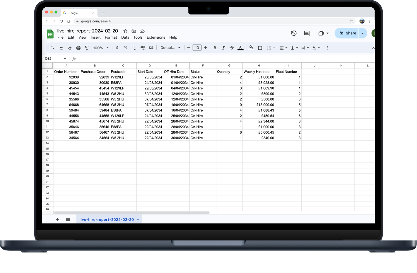
Gone are the days of requesting a live hire report from each supplier. Not to mention that they are no longer ‘live’ when they reach your inbox. In the YardLink platform, you can instantly generate a live hire report, across all suppliers, at a project level. Always know what’s on site, keep a close eye on equipment usage, and be aware of incoming deliveries and collections.
Learn More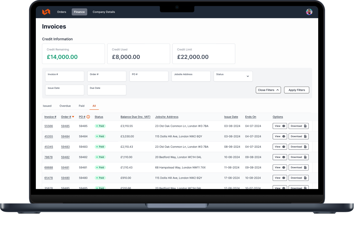
Keep the necessary paper trail, but manage it online.
Put the pen and paper down. Close the spreadsheet. And gain peace of mind with a digital paper trail through the YardLink platform. Standardised quotes, proof of delivery, and invoices (no matter the supplier), means fewer disputes and queries. Easier to manage and track. Our goal is to help you work smarter, not harder.
Learn More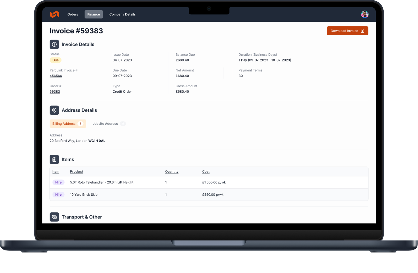
Tackle overspending and spiralling budgets.
Wave goodbye to failed collections and aborted fees. Reduce the number of invoices in query and associated penalties. And, you no longer have to accept the heightened costs of using non-local suppliers. We always connect you with the closest available supplier. Less wasted miles and lower delivery costs.
Learn MoreTAKE THEIR WORD FOR IT
Construction Contractors Across The UK Rely On YardLink For The Best Equipment.
4.9
Excellent rating Reviews.io
"Fast, efficient and economical. They take the hassle out of every hire.”
Frank Lake
Director
“YardLink's quotation process has enabled us to improve our procurement function."
Daniel Horton
Logistics Commercial Director
“Hiring plant and tools has never been easier. We use YardLink for all our kit."
Richard Barker
Director
“YardLink’s platform still gives us access to the national and local suppliers we love, but through a single view.”
Mike Robinson
Procurement Controller
"Since using YardLink, our efforts can be focused on meeting deadlines and exceeding client expectations."
Mark Hornbuckle
Head of Logistics
“They always deliver as promised, with good prices and suppliers.”
Kirils Grube
Director
Surveying & LocatioN Equipment Hire FAQs
Your Questions, Answered.
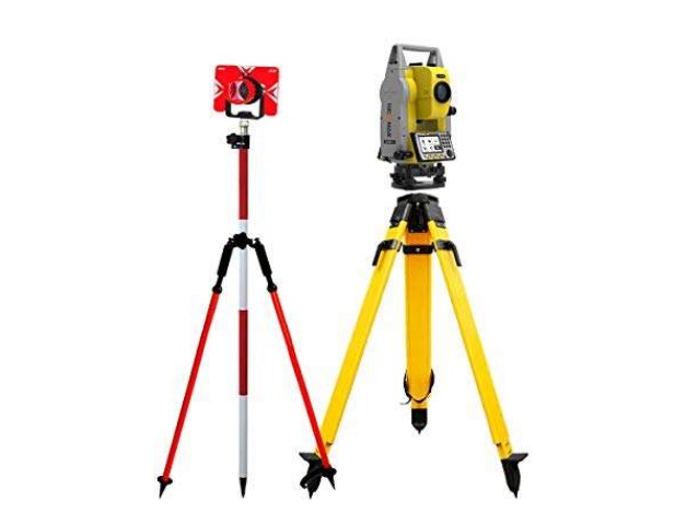
A total station is a surveying instrument that combines a theodolite for angle measurement and a distance meter. It is used to measure angles, distances, and coordinates, allowing precise positioning and mapping of points on a construction site.
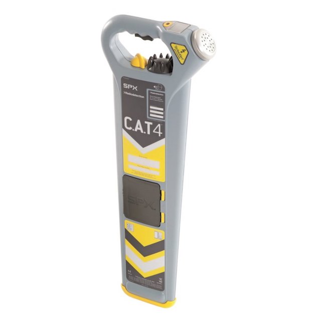
GPS equipment uses satellite signals to determine accurate positioning on the Earth's surface. In surveying, GPS receivers are used to collect data on coordinates and establish control points for mapping and geospatial applications.
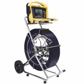
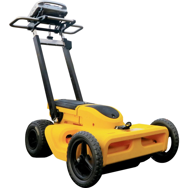
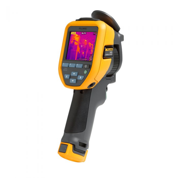
A laser scanner is a device that emits laser beams and captures the reflected data to create detailed 3D representations of surfaces and objects. Laser scanners are used in surveying for creating accurate and comprehensive point cloud data for building information modelling (BIM) and site documentation.
Theodolites are precision optical instruments used to measure horizontal and vertical angles. They are commonly used for tasks such as triangulation, traversing, and setting out points in construction and land surveying projects.

blog
Latest Articles